Red Roses for Heroes

 It was spring 2004 almost one year after the American-led invasion of Iraq – a policy that was not well accepted in France. We had not sensed any hostility from the French people towards Americans, but many were clearly unhappy with the actions of the American government.

We had been touring battlefields near Chateau-Thierry and in particular Belleau Wood, the scene of the United States Marines’ month long struggle to capture that tough piece of terrain from entrenched German defenders. Our accommodations were to the east of Chateau-Thierry in a small B&B owned by two Americans who had spent their professional careers working in Paris. They retired to enjoy the rural French lifestyle and ran the B&B as a sideline. On the evening that we arrived, over a glass of white wine, they told us the following story.

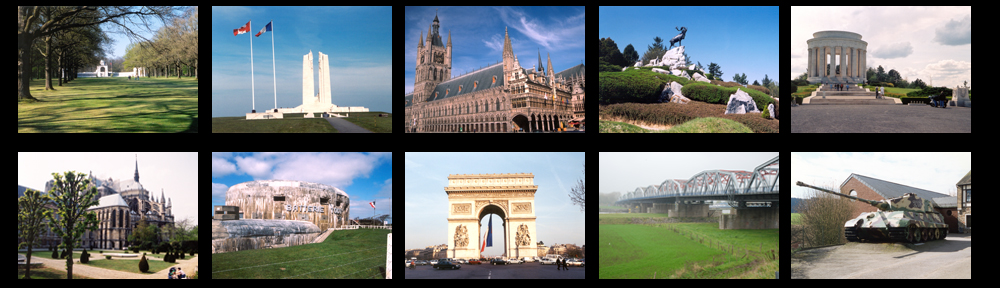
The French are great for commemorations of the events of the two world wars. The First World War is remembered each year in every town and village on 11 November typically with a simple commemoration at the town’s war memorial followed by a vin d’honneur – a mini reception of Champagne and canapés held in the village hall. Cities frequently celebrate with elaborate parades and ceremonies, such as that at the Arc de Triomphe in Paris.  To a lesser extent, the Second World War is commemorated on 8 May. American contributions to both wars are recalled during ceremonies at the nineteen American military cemeteries in Europe on Memorial Day in late May. Continue reading

Battle of Poitiers

In 1356, Edward III, the victor at the Battle of Crécy, sent his son, Edward the Black Prince, to lead a chevauchée through northern Bordeaux. This scorched earth warfare was designed to weaken the French populace’s support for their king. John II, king of France and known as ‘the Good’ assembled a force estimated at 16,000 – 20,000 men and forced an engagement south of the ancient city of Poitiers. Edward’s forces were considerably smaller than John’s and he had no wish for a battle. His interests were to escape to Bordeaux. He arrived at the Abbey de Nouaillé.

01b Battle of Poitiers: 19 September 1356
Département: Vienne
Region: Poitou-Charentes
Country: France

A French Battlefields “Virtual Battlefield Tour” [This battlefield is not included in Fields of War.] Unfortunately, the battlefield of Poitiers is not well served by Google Maps streetview. Few of the roadways near the battlefield have been photographed utilizing this process.

Summary:

Edward positioned his forces with their backs to the Bois de Nouaillé; Earl of Salisbury’s division to the north; himself in the center; and Ear of Warwick’s division to the south. The French ‘battles’ were in four rows with a small group led by Marshals de Clermont, d’Audrehem, and Brienne in front followed by the Dauphine, duc d’Orléans, and King John in the back. The main French body, led by the Dauphine, was unable to break the English line and fell back. Upon seeing this, the duc d’Orléans also withdrew, leaving the battle to King John’s division, which advanced upon the tiring English. Edward sent Captal de Buch in a sweeping arc to the east and north to come upon the French flank. Attacked on two sides, French resistance crumbled and John was captured.


View Battle of Poitiers 19 September 1356 – A Virtual Battlefield Tour by French Battlefields (www.frenchbattlefields.com) in a larger map

French Battlefields presents a new way to tour military sites.

Do you always want to see what Omaha Beach looked like from the perspective of American soldiers on D-Day? What did the First World War trench lines look like? What exactly did the Waterloo Battlefield look like to Napoleon or to Wellington? How about the spot in Rouen’s medieval quarter where Joan of Arc was burned at the stake?

For those who cannot bear the expense of traveling to distance countries, but who have the desire to see where historically significant military events took place, we have developed a new tool that takes you there. Virtual Battlefield Tours allow armchair military enthusiasts to place themselves in the actual location of famous engagements and heroics actions on northern Europe’s numerous battlefields.

The basis for these tours is the free Google Maps web site and it does not require any additional computer software or expense. These maps can be viewed from computer, smart phone, tablet, or any device that can access the internet.

Google maps is a wonderful tool to view the world. Its satellite view option permits seeing the chosen site from directly above, thus allowing one to see the seashore, lakes, rivers, villages, and forests as they exist today. Move to street view by clicking on and dragging the little yellow man icon to get right down to ground level to see buildings, fortifications, memorials, street signs, road intersections, or anything that a camera can pick out on the ground. Additionally, little blue dots indicate those locations where others have posted photos onto the map to show things what sometimes is not visible with the Google streetview cameras.

Like any technology, there are a few caveats: for the most part, streetview is not available in Germany or Luxembourg and small details are outside the resolution of the streetview cameras; many of the inserted photos are not placed in the exactly correct location, people have been a little sloppy about that; and, finally, you have to know where battlefield events took place.

That’s where Virtual Battlefield Tours come in. French Battlefields, utilizing its extensive directory of battlefield locations developed during the writing of Fields of War: Fifty Key Battlefields in France and Belgium, has identified these exact locations. Customized Google maps now identify terrain features, memorials, historic buildings, museums other features pertaining to the battle and mark them with its custom icons. Each icon is accompanied with a brief description of the site and, in most cases, photographs of the site. Clickable links offer instant access to museum or tourist office websites.

Now, from the internet website http://www.frenchbattlefields.com/ or our corresponding blog site at www.frenchbattlefields.com/blog you can find the battle of your interest and see what the participants saw, what remains of fortifications, and how the battle has been remembered and commemorated. On the website, click ‘Maps’ to be taken to a menu of wars and engagements. On the blog site just click ‘Categories’ on the right hand column, then scroll down. Click on ‘Virtual Battlefield Tours’ and all of the tours will appear. In both cases, a small version of the map is below each summary; click on the link below the map to take you to the Google custom map location. Enjoy wandering the fields and villages of Europe.

This massive undertaking is an ongoing project and only a limited number of battlefields are currently available. On the blog site, click ‘Entries RSS’  at the bottom of the screen to be automatically notified by email of new additions to Virtual Battlefield Tours.

Battle of Formigny

Although the French king, Charles VII, did little to save the life of Jeanne d’Arc, he used the succeeding years to strengthen his position in France. In 1444, Charles and the then king of England, Henry VI signed the Treaty of Tours, which guaranteed a temporary truce between the two countries, the marriage of Margaret of Anjou to Henry, and the transfer of the province of Maine to Charles. As happened to so many of the truces of the Hundred Years War, it did not offer the prospect of a permanent settlement. Margaret was only a distant relation to the French throne and she was impoverished therefore coming without a dowry. When Henry attempted to renege on the transfer of territory, Charles threatened by collecting a large army and by 1448 Henry acquiesced.

03f Battle of Formigny 15 April 1450
Département: Calvados
Region: Basse-Normandie
Country: France

A French Battlefields “Virtual Battlefield Tour” [This battlefield is not included in Fields of War.]

Summary: Hostilities recommenced in June 1449 with the reorganized French Army taking advantage of the weakened English by capturing major cities in Normandy including Rouen, Harfleur, Honfleur and Lisieux. Their next objective was Caen.

The English gathered a small army of about 3,000 men under the command of Sir Thomas Kyriell and left Portsmouth for Cherbourg landing there on 15 March 1450. Kyriell marched south to capture Valognes as the 5,000-man French Army, under Charles I de Bourbon, Comte de Clermont, marched towards Carentan. Kyriell circled around Carentan, refusing to offer battle, and was heading for Bayeux when he entered the village of Formigny on 14 April. The main French force under Charles followed from Carentan towards Bayeux along the later famous National Road 13 as a smaller, but French force of 1,200 fully mounted men under Arthur de Richemont was approaching from St-Lô.


View Battle of Formigny: 15 April 1450 – A Virtual Battlefield Tour by French Battlefields (www.frenchbattlefields.com) in a larger map

Continue reading

Shrapnel Charlie

He was a carpenter suffering idleness following a severely disabling work accident and looking for some activity to occupy his idle hours. He had to keep his hands busy to keep his mind off on his constant pain. He could also not escape from where he lived. Ivan Sinnaeve lived in the heart of the Ypres battlefield of the First World War.

Ypres was a provincial town whose glory days were in the Middle Ages. It was seldom thought of outside the region until the opening months of the war. The initial German invasion of 1914 had carried across most of tiny Belgium before being stopped at the gates of the city by an Allied Army of French, Belgian and British soldiers. However, the action had left Ypres at the base of a protruding salient into enemy lines under continuous observation from enemy controlled high ground. For the next four years the German Army tried to eliminate the salient and the British Army defended it.

Ypres Menin Gate

Ypres was shelled, bombed, cursed, and died for thousands of times over. In military texts the battles around Ypres are given numerical titles; the 1st Battle of Ypres, the 2nd Battle of Ypres, the 3rd, the 4th. To the survivors, however, the battles have other names; the Gas Attack – the first use of poison gas in warfare in April 1915; Messines Ridge – the simultaneous explosion of nineteen mine shafts under German lines which obliterated 10,000 soldiers; and the ultimate obscenity – the Battle of Passchendaele. Continue reading